Super Tuesday Fun with Highways: I-80

So how to continue our “primary highway series” when so many states are voting at once? Well, we can't visit them all, but we touch several important places with a trip along Interstate 80. I-80 runs the entire width of United States connecting New York City to San Francisco, two cities to which I have connections. In between New York and California, it crosses three other states voting this Tuesday: New Jersey, Illinois and Utah. We have already visited two other states crossed by I-80, Iowa and Nevada, during earlier contests.

Actually, I-80 never enters New York. Rather, its eastern end is in Teaneck, a town on the New Jersey side of the George Washington Bridge:

It would have been cool if I-80 crossed the bridge along with I-95 into New York. Perhaps then splitting at the Bruckner Interchange in the Bronx (yes, I had to get the Bruckner Interchange into this article) before heading out to Long Island.

North of New York City is Chappaqua, “hometown of CatSynth and Hillary Clinton,” as I have mentioned a few times on this site. And while it is my hometown in that I grew up there, Hillary's original hometown is a little bit west of New York and New Jersey, in Chicago. But of course you can get there by heading west on I-80, which passes through Chicago's southern suburbs.

Chicago is all the home of Barack Obama. So we have two candidates with Chicago roots, either of whom I would be very happy to support.

What a strange position to be in, to have such a choice – and I admit I have had a hard time deciding. There are historic opportunities with each, connections to various aspects of my own life (geography, education, mixed heritage). I guess it's much better than 2004 when I was excited about no one.

Traveling further west along I-80, we eventually come to Utah, a place of striking natural beauty that I would love to visit again soon. In the south are canyons, stone formations and other wonders of the southwest. In the north, along I-80, are the Great Salt Lake and the Bonneville Salt Flats:


[Click to enlarge]

When they say salt flats they mean flat. It is an incredibly stark landscape, and that's part of what makes a great experience. And the silence. Longtime readers know how such things appeal to my personal and aesthetic sensibilities. Although I have been to the Great Salt Lake, I did not get to see Robert Smithson's Spiral Jetty, which is considered a major work of modern American art, and which I have seen reproduced countless times.

Heading further west, we cross Nevada and then arrive in California, where I-80 crosses the Bay Bridge into San Francisco, my new hometown.

I-80 actually ends as the western approach of the Bay Bridge, although most people (and road signs) suggest that it continues into San Francisco to US 101. This section of freeway actually cuts through my South-of-Market (SOMA) neighborhood, contributing to its urban, industrial feel.


[Click to enlarge]

I did manage to find my polling place, and will soon have to make a choice as this election season reaches home. But it is great that those of us in California finally get to make a difference. Same for the folks in New York, New Jersey, Illinois and Utah. So many of us have had very little opportunity to actually have a say in the process, long dominated by Iowa and New Hampshire and the South. The rest of the country will finally have to listen to the people in our major urban centers and in the west. And I'll be satisfied with whomever we end up choosing (at least in one party).

Fun with highways: Des Moines, Iowa

Like a lot of people, our attention today was focused on Iowa. And within Iowa, on its capital and largest city, Des Moines.

My only personal experience with Des Moines is traveling through on I-80, one of several major highways that meet here, including I-35, US 65 and US 6. The main highway through the city itself is I-235, which includes this cool pedestrian bridge overlooking the downtown. It actually reminds me a bit of the pedestrian bridge to the Marina in Berkeley, CA – which happens to span I-80, just a few miles to the west.


[click for photo info]

But this pedestrian bridge across Gray's Lake is even more interesting:


[click for photo info]
And yes, they hold this big event every four years in Iowa. And somebody gets to win it. This year, congratulations go to Barack Obama.

While we at CatSynth are not officially endorsing anyone (why would we do that?), we have enjoyed watching Obama's rise, along with the more youthful, energetic and sophisticated crowd that follows him – the same “college kids” that were sneered at in Iowa four year ago when they supported Howard Dean.

And of course we have no illusions about CatSynth's contribution, but it's a nice footnote if I he does go on to become President…

Sacramento Valley and Mt. Shasta

This is the first of several articles on my recent “grand loop” through northern California in August. Starting from the Bay Area, north through the Sacramento Valley to the Cascades (including a side trip to Lassen Volcanic Park), and then west to the Mendocino coast and back south to San Francisco.

The segment of this trip is along I-80, crossing the Bay Bridge and north through Berkeley into the towns of the “North Bay” that always seemed remote even when I was lived in the area. I-80 crosses over the New Carquinez Bridge into Solano County, ultimate towards Sacramento.

In order to head north without having to get too close to our state's capital or Arnold, one takes the short-cut known as I-505 into the Sacramento Valley. This is a largely agricultural region of fields and orchards, and it is flat. As in “how much more flat could you be? None more flat.” (Apologies to Spinal Tap).

One of the interest sites along the side of the road was this flock of sheep, doing what sheep do best, except for that one looking straight at us:

Somehow, sheep are always instant humor. I am not sure why, but it's a fact, they're just funny even when they're not doing anything. We need to confer on them some sort of hip cult status befitting their character. Baaaa!

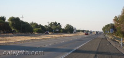
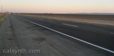
I-505 soon rejoins the main I-5 freeway coming north from Sacramento towards the Oregon border. Somehow, I-5 manages to appear even flatter than 505:

However, such images are a bit deceiving. While the Sacramento Valley is indeed very flat, it is quite visibly bounded by mountain ranges. To the west is the inner Coast Range, and far to the east are the foothills of the Sierra Nevada range. There are also the Sutter Buttes, dubbed the “smallest mountain range in the world.”


(Click to enlarge)

Whether we are seeing haze or the infamous Central Valley pollution in this photo isn't clear (no pun intended). The Sutter Buttes are actually quite a distance away from I-5. One surprising characteristic of the Sacramento Valley, at least during this visit, was how humid the air felt, so it could easily just be haze.

Pretty much things continue this way along I-5 until one reaches Redding, the largest city in California north of Sacramento, and the gateway to the Cascades. Very quickly, the highway begins to climb into the foothills, winding its way along the sides of hills and over high valleys (one of which was flooded to create Lake Shasta). No sign of Mt. Shasta. The directions to get there includes those famous words “You can't miss it”, but a first time traveller might begin to doubt that aminst the endless steep green hills and valleys. But then, there it is. And yes, you can't miss it.

Oh, and here it is again:

Shasta is a volcanic peak, one of the tallest in the Cascades, and is distinct for being very disconnected from any other other tall peaks. About the closest I could find nearby was this peak which I simply dubbed “pointy mountain:”

“Pointy Mountain” turns about to be Black Butte, a nearby lava dome (not to be confused with Black Butte in Oregon). It is clearly visible from the town of Mt. Shasta on the other side of I-5 (town on the east, peak on the west).

It is from the town of Mt. Shasta that we take this final shot of the mountain, a little before sunset time:


(Click to enlarge)

One thing to note is the lack of snow on the mountain. Granted it is August, but I was here in August 1998 and remember seeing a lot more snow, This is probably a product of our drought in California, including relatively little rain/show this past winter. Whether or not the trend continues, and mountains like Shasta become less “snow-capped”, remains to be seen…

Live from Berkeley, Part 1

Tonight's posts are coming to you from Berkeley, my home for six years while I was a grad student at the university. I was invited up for a two-day mini conference by my former colleagues at the Center for New Music and Audio Technologies and the recently created research group for parallel computing (aka “the View from Berkeley”). The interesting technical topics will have to wait for some other time – though I can't imagine the EECS faculty would enjoy seeing their research reviewed by a blog about cats…

For now it's simply worth noting that I'm sitting out with my laptop and a hot cider at an outdoor on a summer night. It's one of many things to miss from this much larger town, even as conference participants told me how lucky I was to now be living in Santa Cruz. I of course enjoy the ocean and the interesting cast of characters in my current home, but regular readers also know that I often miss being in a more urban environment…

It is interesting to compare Berkeley and Santa Cruz. Berkeley is much larger, more urban and culturally vibrant, better food, and spectacular streets to wander in the hills – stay tuned for more on that in part 2. Santa Cruz has the ocean, it's calm laid-back character, and an interesting community of creative and artistic people. Interestingly, Berkeley had little to no “night-life” in terms of live music and clubs during the time I was there. The nightlife in Santa Cruz is nothing to brag about, either, but it does have several live music venues that have managed to stay open despite the best efforts of residents to close them down – I never understand why people who hate nightlife live in downtown areas. In any case, almost every place in Santa Cruz closes by 10pm except a few clubs/bars, while in Berkeley things at least stayed open until 2am or later. I'm not sure one can conclude much from this comparison, except that either town would be a better place to live than most…

Not too much interesting to describe from a travel point of view, unless you count the Bay Bridge, which I don't think I have drivin in quite a while. There is a lot of contruction on the San Francisco approach, it looks like they might be trying to fix the remaining “errors” left over from the earthquake and subsequent demolition of the Embarcadero Freeway. With the changes to the 101 freeway described in a previous post, the 80/101 corridor might start to look civilized.

Then there is of course the new eastern section of the Bay Bridge (to replace the current seismicly dubious eastern span), which remains under construction. I wonder when they're planning to finish that…

Seriousness with Highways: MacArthur Maze

I had planned to do a “fun with highways post” on the MacArthur maze, which connects highways I-80, I-580 and I-880 to the Bay Bridge in Oakland:

Well, it turns out not to be so “fun” at this time. A major tanker truck crash and explosion in the southest corner of the maze. The resulting conflagration on the elevated southbound I-880 melted the steel of the even more elevated eastboard connector from I-80 to I-580, which eventually collapsed onto the lower highway.

Please visit this article to view images. You can see a video taken by an eyewitness at the time of the fire. Watch it here instead of at the YouTube site in order to avoid the boorish and in some cases quite inappropriate comments.

This looks like it was rather intense, and scary. Indeed it was rather freaky to see the charred freeway photos last night when first logged on last night. I know that section of freeway quite well from my time in Berkeley and frequent trips to San Francisco and the East Bay since then. That section of southbound 880 had only re-opened a few years ago, having been closed and then rebuild after the infamous collapse of the 880 double-decker freeway in the 1989 earthquake.

Fortunately, the driver of the truck escaped with only moderate burns, and nobody else was hurt in either the fire or the collapse of the freeway. Presumably when you see something like that ahead of you, you opt not to keep heading into it. The area is also fairly spare industrial land, so no homes in West Oakland were threatened. Could have been a lot worse, I suppose…